Exploring Iceland's South Coast: Seljalandsfoss, Dyrhólaey, and Reynisfjara Beach
Before Myles and I departed for the south coast of Iceland, we had breakfast in the lobby of Reykjavik Lights. The dining area was beyond the bar, in a part of the hotel with no windows. There were rows of white tables with white chairs, next to a white table which held fresh cantaloupe, grapes, oranges, and watermelon on white plates. Warm bread was placed alongside peanut butter and Nutella. Sweets were nearby the bread, with a tower of muffins, croissants, cookies, and donut holes. Self-serve containers of coffee, tea, orange juice, cereal, and milk were behind the table of food, with a pot of hot oatmeal.
The first attraction for the day was Seljalandsfoss, a waterfall located seventy-seven miles to the south east of the Reykjavik. On the way out of the city, Myles and I stopped at an N1 gas station along the highway. Visually, gas stations in Iceland are no different than in the United States. There were rows of fuel pumps, which accepted credit cards. Inside the station, coolers were stocked with soda, energy drinks, electrolytes, and cold coffee. Snacks were neatly arranged in aisles. A favorite of mine were fruit sticks from a brand called Castus. The price of fuel, however, was nearly three dollars a liter, which pushed the price per gallon past ten dollars. In total, I spent one hundred dollars to fill the tank.
From the N1 gas station, Myles and I stayed on Route 41 until we connected with Route 1, or the Ring Road. The Ring Road, as the name implies, circles the entire country of Iceland. Past the town of Hveragerði, which is near the Reykjadalur Valley, Route 1 snakes through rural farms, nestled below snowcapped mountains and volcanos. Alongside the slopes were loose rocks and colossal boulders. Sheep were everywhere, behind dug trenches and side by side with the road. The North Atlantic was nearly visible from the passenger side, beyond plains of nothingness.
Seljalandsfoss and Kvernufoss: Iconic Waterfalls Along the Ring Road
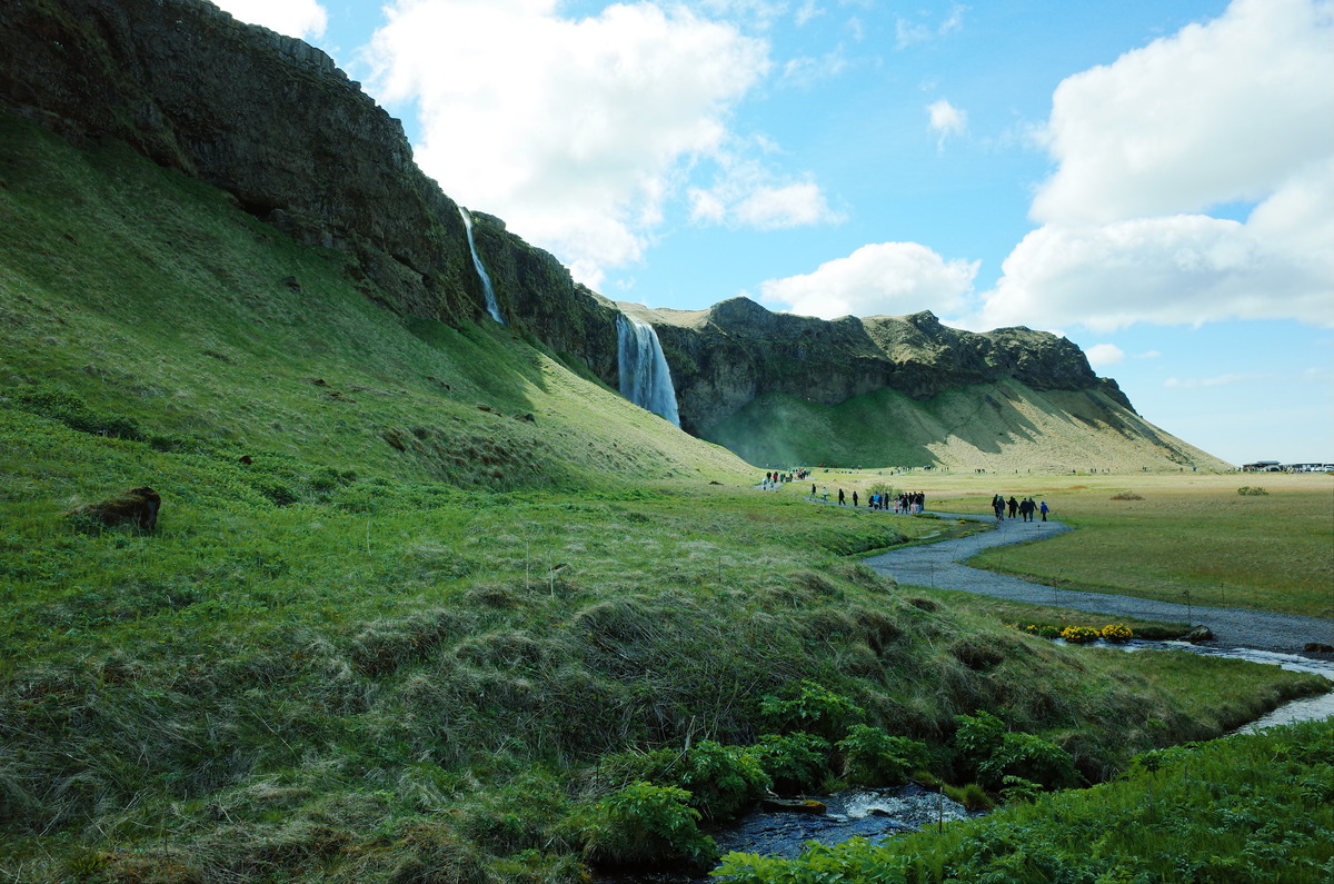
Eastward on Route 1, Seljalandsfoss is visible from afar. The waterfall plunges two hundred feet from a cliff, and is served water from the Seljalands river, a side-effect of the melting glacier Eyjafjallajökull. Myles and I parked near a gift shop in the style of a cabin. As we had circled behind Seljalandsfoss in 2018, we walked a half mile to the north to visit Gljúfrabúi. The waterfall is overlooked, tucked into a wet cleft along the same rock face of Seljalandsfoss. Inside the canyon, in front of Gljúfrabúi, is a climbable boulder. Myles took a photograph of me atop the boulder in an upward angle, which exposed the 131 foot cliff.
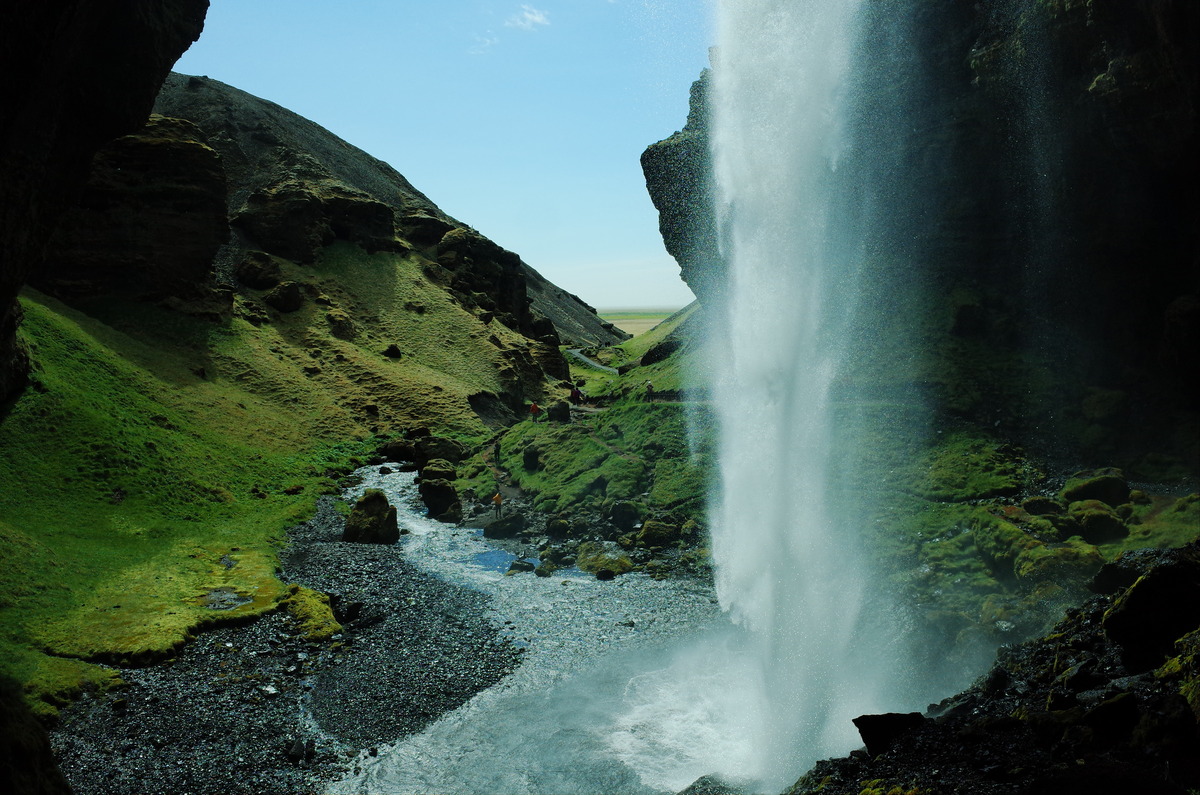
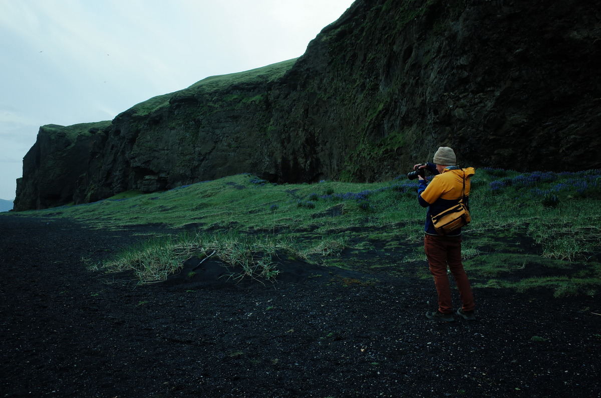
Myles and I kept our time at Seljalandsfoss and Gljúfrabúi short to maximize the day along the coast. We drove thirty minutes to the east of Seljalandsfoss to Kvernufoss, one more waterfall which receives infrequent attention. In comparison to the swarm of tourists at Seljalandsfoss, we were able to walk behind Kvernufoss by ourselves. The waterfall is tucked into a gorge, and is shrouded in constant mist, which blankets the area and nearby organic overlook. As the canyon was devoid of people at the time, I scrambled atop the overlook and used my field recorder to sample the white noise of water as it fell one hundred feet.
Before Myles and I departed Kvernufoss, I stopped into the Skógar Museum to browse souvenirs. In a display case was a miniature white sheep made of glass. As Myles and I had passed hundreds of sheep along Route 1, I chose the sheep as my token, or symbolic trinket, for the trip. I’ve bought a sole token for each trip since 2017. In my collection are toy taxi cabs from Manhattan and Kyoto, a troll from Norway, a wax Godzilla figure from a movie premiere in Tokyo, a JR-East subway car from Tokyo, a ceramic Romanian house, and a scale Mount Fuji from Yamanashi Japan. My token for Iceland in 2018 was a metal figurine of the god Thor.
Walking to the Sólheimasandur Plane Crash
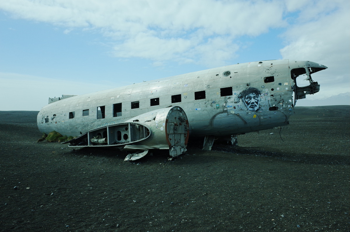
The next destination was the Sólheimasandur plane crash, located a half hour to the east of Skógar. Myles and I visited the C-117D in 2018, which has remained along the southern coast since 1973. The earthen car park for the crash site is along the edge of Route 1, marked by a thin wire fence. We were surprised to see a shuttle bus, a paid service not available in 2018. Myles and I elected to walk the two miles to the plane. The foot path is flat and marked with yellow poles. Due to the absence of trees, boulders, and hills, wind flowed freely. Gusts constantly pushed me from the west, which made the two mile walk feel lengthened.
Upon arrival to the crash site, Myles and I had the plane to ourselves for a short period of time. In comparison to our last visit, the fuselage was in rough shape. Weather and people had not been kind. Large pieces of the nose and cockpit had been removed. What remained of the cockpit was covered in graffiti, hundreds of stickers, and pellet sized holes in a splatter pattern. Although the port side remained intact, new holes had been punctured on the starboard side. Before a group of tourists converged on the plane, Myles and I took photographs from the starboard side, as it blocked the wind and concealed the shuttle bus with tourists.
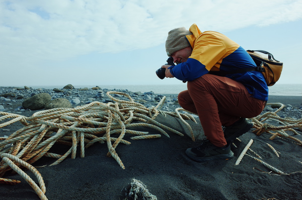
Beyond the plane to the south was the North Atlantic coast. The beach went on for miles to the east and west. Amongst the dunes was a dead seal, half buried in the sand. The body was located farther than the tide went. It was an odd sight. The torso was intact with undamaged skin but the skull was exposed. There was no blood or visible flesh. An old thick rope was nearby, washed in long ago. It was coiled in and out of the sand. Exposure to weather had hardened the rope to a solid quality. As I photographed the seal and rope, the wind carried sheets of sand into the air, which pelted my outer jacket. It was a rough area.
Exploring Dyrhólaey and Reynisfjara Beach
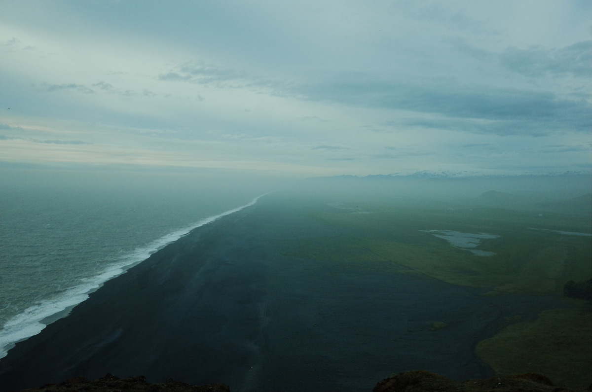
Dyrhólaey, a small promontory on the south coast of Iceland, was next on the itinerary. Located a half hour to the east of the Sólheimasandur plane crash, Dyrhólaey provides a comprehensive overlook of the coastline, the rock formations of Reynisdrangar, and a mass of Mýrdalsjökull. In comparison to 2018, a two lane road had been paved with guard rails. A dirt path once ran to the top, without safety barriers amongst the steep drop-offs. What remained was wind. On a good day, wind speeds average twenty to thirty miles per hour near the light house. On our particular day, the wind speed approached fifty miles per hour.
At the lighthouse atop Dyrhólaey, the wind made photography difficult. I belly crawled to edge of the overlook and rested my camera on a flat rock. The coastline was visible for miles to the west. Afterwards, I descended the backside to the Reynisfjara viewpoint while Myles photographed the lighthouse. Until I reached a staircase made of rock, gusts pushed me ahead with constant thrusts. I had never experienced such forceful gales. At the bottom of the descent was a vehicle lot with a bathroom, which cost two hundred Icelandic Króna to use. A stretch of Reynisfjara beach, along with an old ship lifter, was visible from within the washroom.
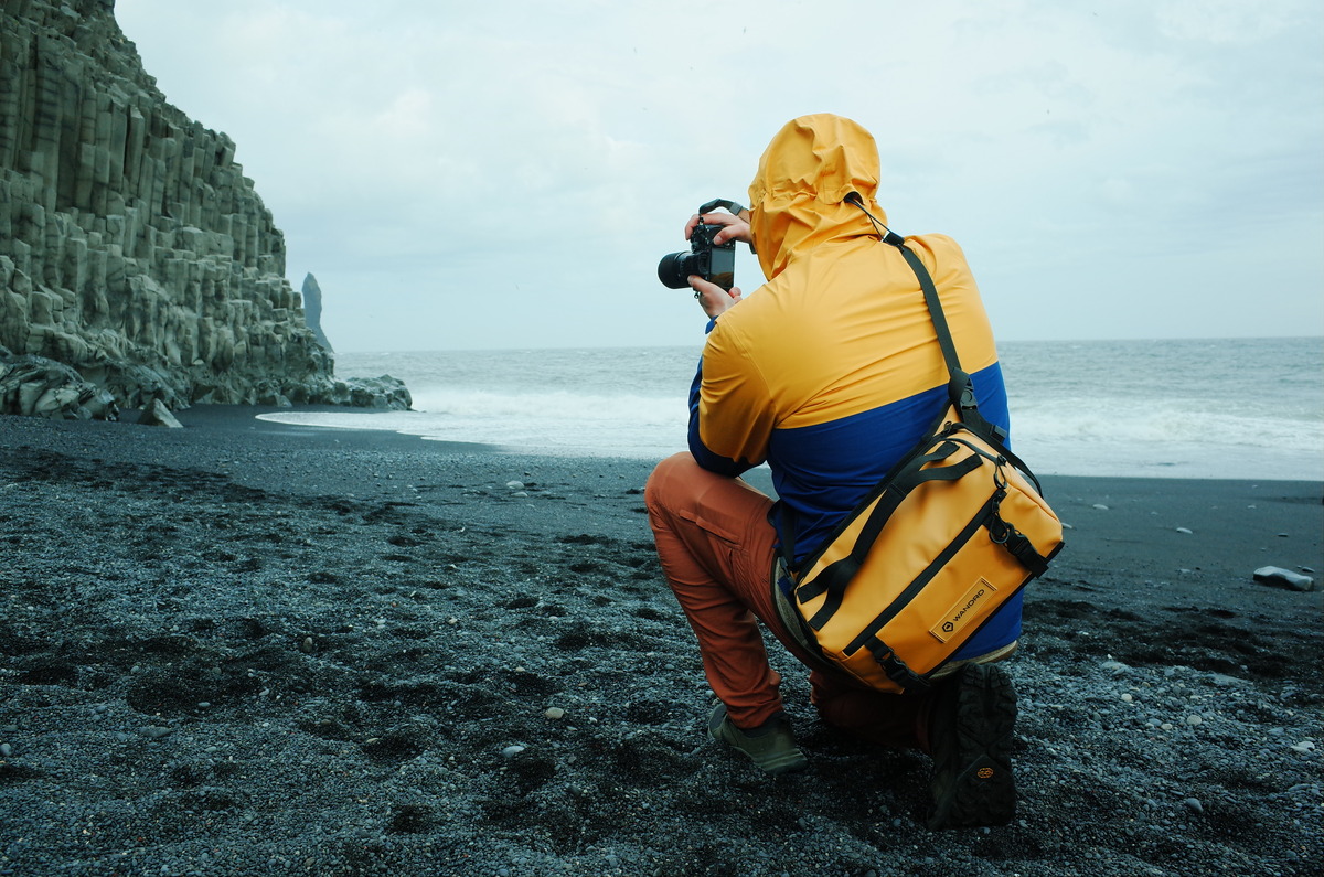
Near the remains of the ship lifter, Myles and I photographed the black sand of Reynisfjara Beach. The basalt columns of Reynisdrangar created a dramatic backdrop next to Mt. Reynisfjall. Sandpipers, plovers, and terns were nestled amongst the cliffs and rock formations of the bay. Sadly, no puffins were present. At sea was a white fishing trawler with casted nets, headed west. In consideration of the wind, the waves were mild. After a share of photographs of Kirkjufjara Beach, we returned to the top of Dyrhólaey via the way we came. The ascent provided a solid knee workout with abundant steps. Each step made me older.
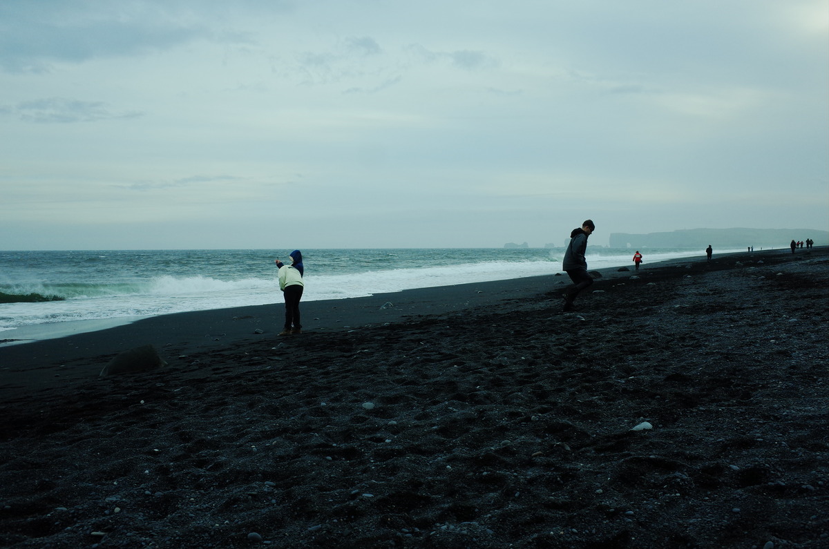
Our next stop was Reynisfjara Beach, known for black sand and sneaker waves. Myles parked near the Black Beach Restaurant, a short distance from the shoreline. As was common with the places we’ve revisited, a parking fee was now enforced. The cost was 750 Icelandic Króna. Before Myles and I explored the beach area, we had our first meal for the day at the restaurant. Myles ordered fish and chips and I had the Black Beach burger. The burger was loaded with lettuce, pickles, onions, and chipotle. It was delicious. Myles, as a picky eater, said the fish and chips were not cooked to perfection. After we ate, we walked out to the beach.
Reynisfjara Beach is a place where the line between beauty and danger is thin. With black sand underneath a sky with heavy clouds, Reynisfjara Beach was otherworldly. Seabirds called out from the blackened cliffs, their cries muted by the sea and wind. Waves crashed against the shoreline with a white foam which contrasted with the dark ground. These waves, however, are unpredictable and swift, and have powerful undercurrents. The tide recedes deceptively and returns suddenly in force. In years past, visitors have walked beyond the recommended safe zone and have been dragged out to sea. The last fatality was in 2022.
Inside the Yoda Cave: Shadows and Scenic Views
After Reynisfjara Beach, Myles and I made our way to Hjörleifshöfði to visit the Yoda cave. The cave, naturally carved into the side of the mountain, bears a resemblance to the iconic Star Wars character. The approach to the cave required a short hike across rocky terrain, with wind a persistent force. The distinct shape is more pronounced from within the cave, with casted shadows which highlighted the rock formations. The entrance frames the landscape outside, which creates a dramatic view of the surrounding plains. Despite the cave’s connection to popular culture, the site is not a tourist attraction and remains quiet.
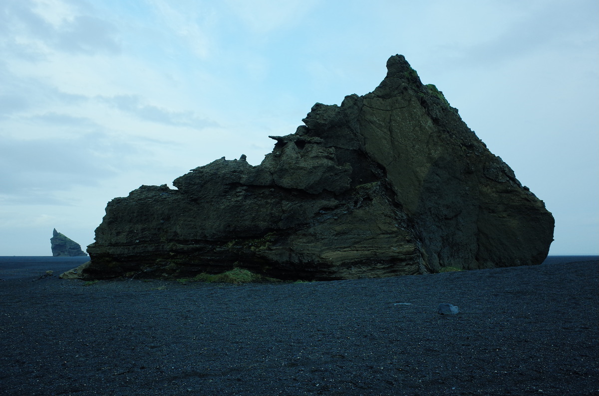
We explored the area outside of the cave and were surrounded by stark contrasts of black sands and lush greenery. Low vegetation dotted the slopes of the mountain, with seabirds nested among the high cliffs. The view of the Mýrdalssandur outwash plain stretched out for miles, an expanse shaped by volcanic activity and glacial rivers. Within the plains near the cave, Myles and I walked a half mile to two large boulders, one of which resembled a troll. The boulders were unclimbable but were picturesque from each side. The solitude of the area, however, was eerie, with an absence of people and structure. Wind was the sole audible noise. We did, however, locate beach glass scattered on the ground.
After we left Hjörleifshöfði, Myles and I returned to Reykjavik Lights. It was a long drive, which took four hours. Traffic was non-existent for miles at a time, which allowed for us to keep a consistent speed the entire way. Vehicles we came across were headed in the same direction. The journey took us westward across the southern coast on Route 1. We passed through dimly lit villages and wide stretches of empty plains. Despite how late it was, the midnight sun cast an eerie glow across the landscape. By the time we reached the hotel, the clock had passed midnight, yet daylight persisted, a reminder of Iceland’s uniqueness.