Snaefellsnes Peninsula: Rauðfeldsgjá, Arnarstapi, and Kirkjufell Highlights
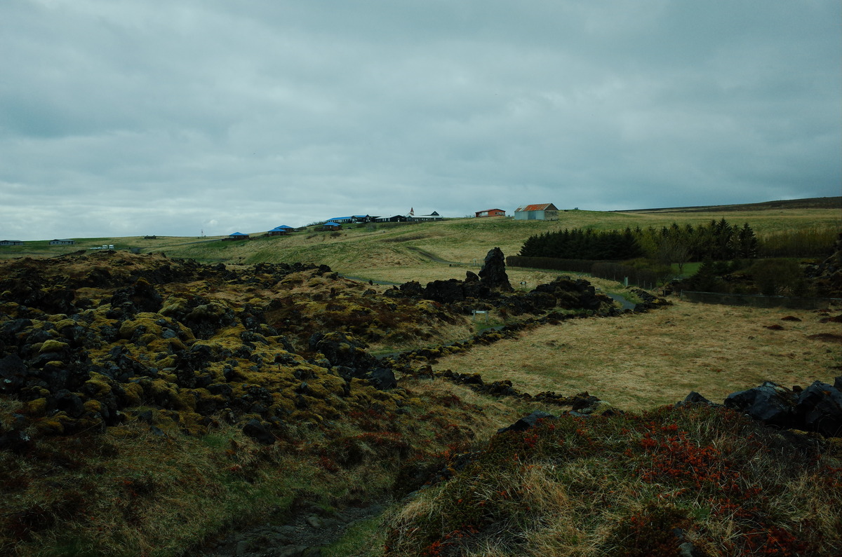
After an early breakfast, Myles and I set out towards the Snaefellsnes Peninsula in western Iceland. The roads to the west led us through landscapes which shifted from farmlands to desolate lava fields. As we approached the peninsula, we were presented with jagged peaks and volcanic formations. The route remained quiet, with scattered farmhouses, and small villages along the way. We stopped briefly at the Snaefellsnes Visitor Center to use the bathroom, where a payment system was in place but out of order. The facility featured an all-gender bathroom, which we had not encountered in Iceland before. After the brief stop, we continued our drive to the west along a road surrounded by rugged terrain.
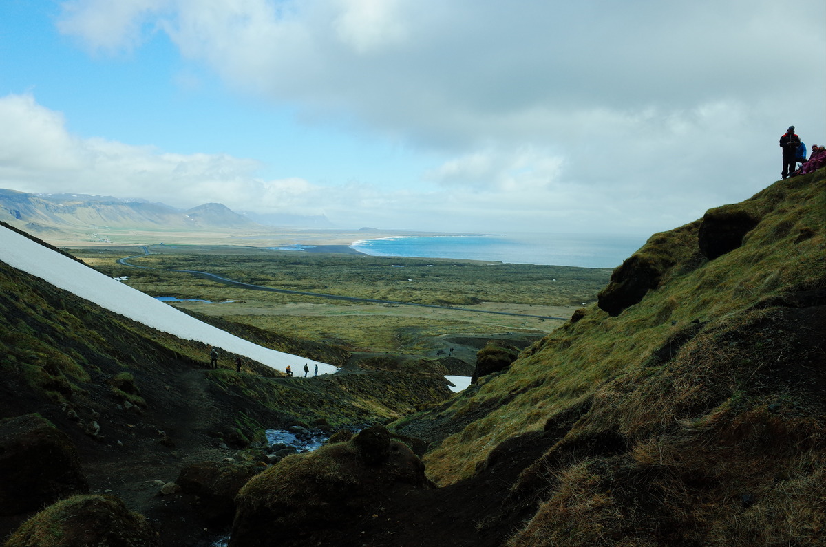
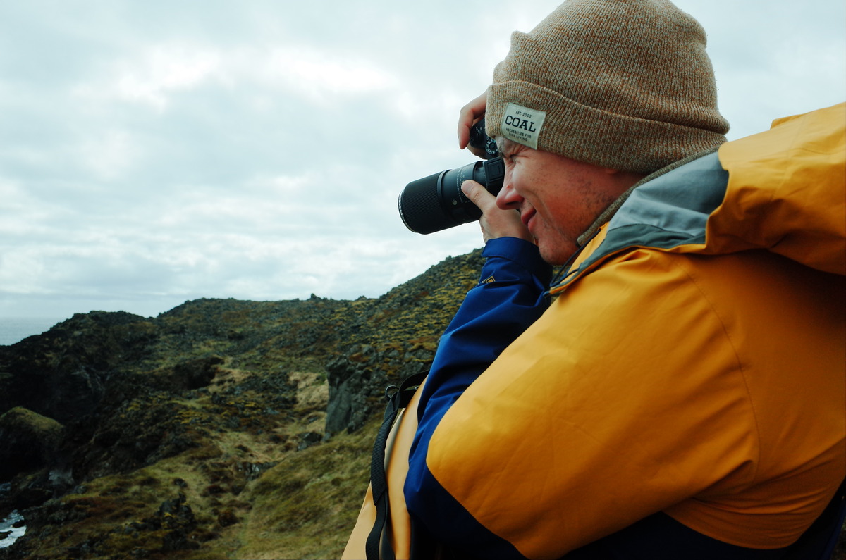
The first stop of the day was the Rauðfeldsgjá Gorge, a narrow fissure carved into a steep mountainside. Myles and I missed the turnoff initially as we drove by but did a one-eighty after seeing a cluster of parked vehicles below a slope of gravel, jagged rocks, and moss. Once we parked, we hiked a short trail to the gorge. Snow blanketed parts of the trail, and the melting ice made conditions dangerous to venture deeper into the gorge where the stream flowed from. I crossed the stream to explore the opposite side, which was the first test for the waterproof boots I had bought. I climbed a nearby hill for a vantage point, where I was provided with a panoramic view of expansive terrain and mountains.
After Myles and I descended Rauðfeldsgjá, we returned to the car and headed further west towards Arnarstapi. The road took us through stretches of more lava fields, and coastal views as the mountains gradually gave way to open plains. The landscape was increasingly remote, with uneven terrain and sharpened cliffs. The jagged coastline drew closer as we approached the small village tucked near the water’s edge. The village of Arnarstapi rests quietly between the mountains and the sea, marked by a cluster of small, weathered buildings. Traditional Icelandic houses with turf roofs and brightly painted facades dot the area, which stand out against the rugged cliffs and darkened coastline.
Arnarstapi and Hellnar
Myles and I stopped for lunch at the Snjófell Restaurant in Arnarstapi. The restaurant exuded an elegant atmosphere, which made me feel out of place in a red Arc’teryx jacket and headband. The place was empty upon arrival but filled with a tour group, comprised of people with binoculars hung on their necks. We both ordered lamb chops, priced at 4,900 Icelandic Króna each. The meal was satisfying, with tender meat served alongside potatoes and a salad. After the meal, we lingered with coffee before we left. The quiet atmosphere contrasted with the busyness outside, where the tour group prepared to move on to their next stop.
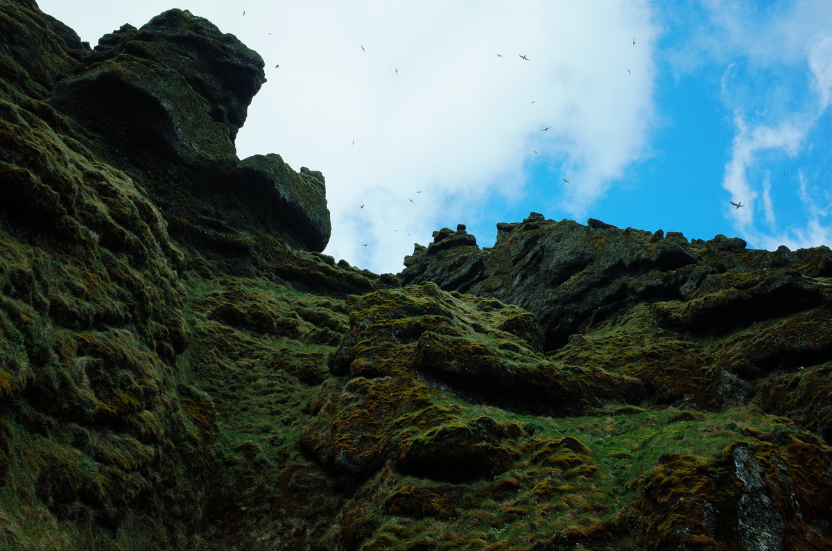
After lunch, Myles and I hiked from Arnarstapi to Hellnar along the coast. The hike offered dramatic views of the coastline. The trail meandered along rocky outcrops, where waves crashed against volcanic stone. In the distance were sea arches and natural formations shaped by centuries of wind and water. As we neared Hellnar, the rugged terrain gave way to gentler slopes with wildflowers. The village presented a quaint scene, with colorful houses nestled against the backdrop of dramatic cliffs. We walked to the sea and encountered a mass of kelp. It was my first experience with kelp, and it was unpleasant with a horrible smell.
Near the bed of kelp were a group of children on a school trip. Their voices echoed off the cliffs as they explored a nearby cave with a narrow opening at the top. After the kids moved on, Myles and I trudged through the kelp to reach the cave with slimy strands clinging to our boots. The slippery surface, along with the loose rocks, made it hard to keep balance, and I slipped more than once. After making our way across, we reached the cave entrance and climbed to the top. The top side of the cave was a grassy knoll, which offered a view of the cove below. We descended through tall grass and slowly retraced our route towards Arnarstapi.
Saxhóll Crater
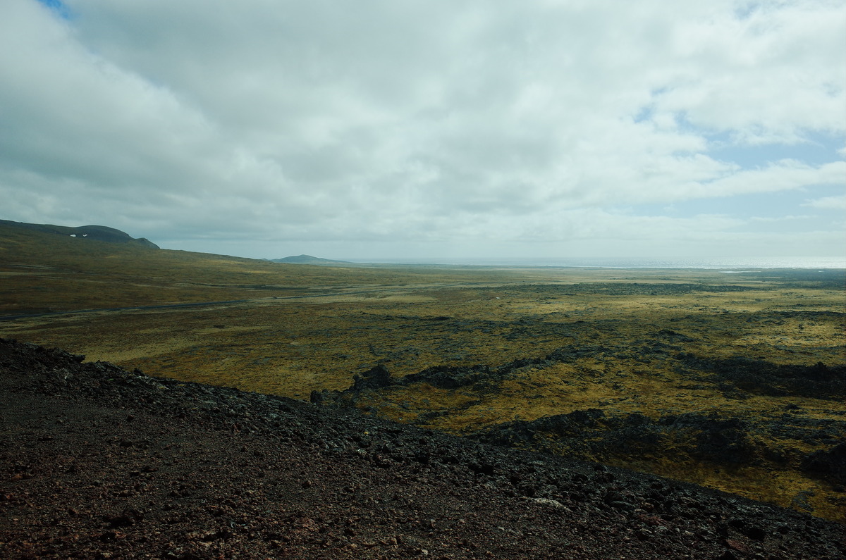
After leaving Arnarstapi, Myles and I continued our journey northwest towards the Saxhóll Crater. The drive provided sweeping views of distant peaks, and the expansive Snaefellsnes Peninsula. Uneven fields of blackened rock flanked us on either side, with patches of moss which softened the harsh environment. As we approached the base of Saxhóll, the crater’s rust-colored slopes stood out against the landscape and sky. A small gravel lot came into view, tucked along the sloping terrain. The wind increased as we neared the crater, which carried a scent of damp earth. Despite the isolation of the area, a steady flow of visitors were at the summit of the crater upon our arrival.
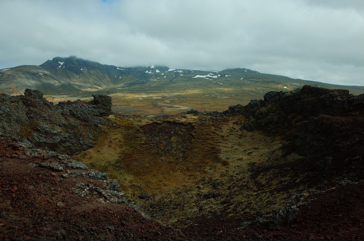
Myles and I parked near the base of 396 rusted steps which led to the top of the crater. The width of the steps provided room for people to walk side by side, but there were no guardrails or safety ropes in place. Our ascent was slowed by other tourists, but we were in no rush and I had a good leg workout. We had a panoramic view of the coastline, where the ocean met the land in a jagged, unbroken line. The wind became stronger closer to the top but was mild in comparison to Dyrhólaey. Once at the summit, the full scope of the crater came into view, which was in the shape of a wide bowl surrounded by remnants of ancient lava flows.
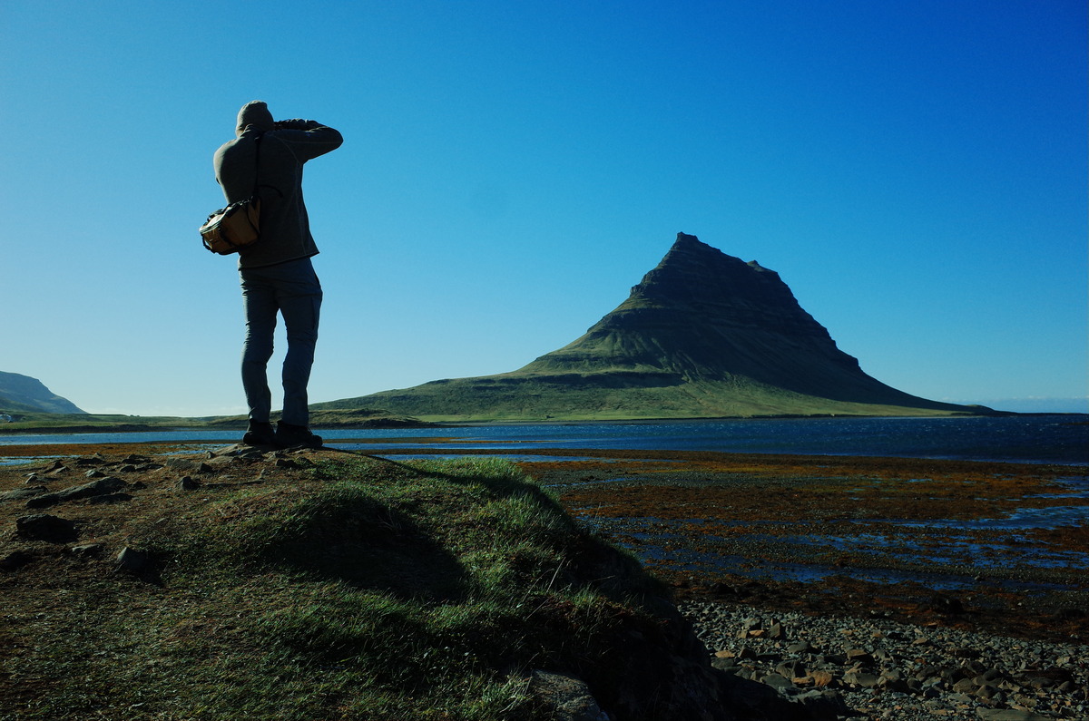
Kirkjufell and Pizza in Grundarfjörður
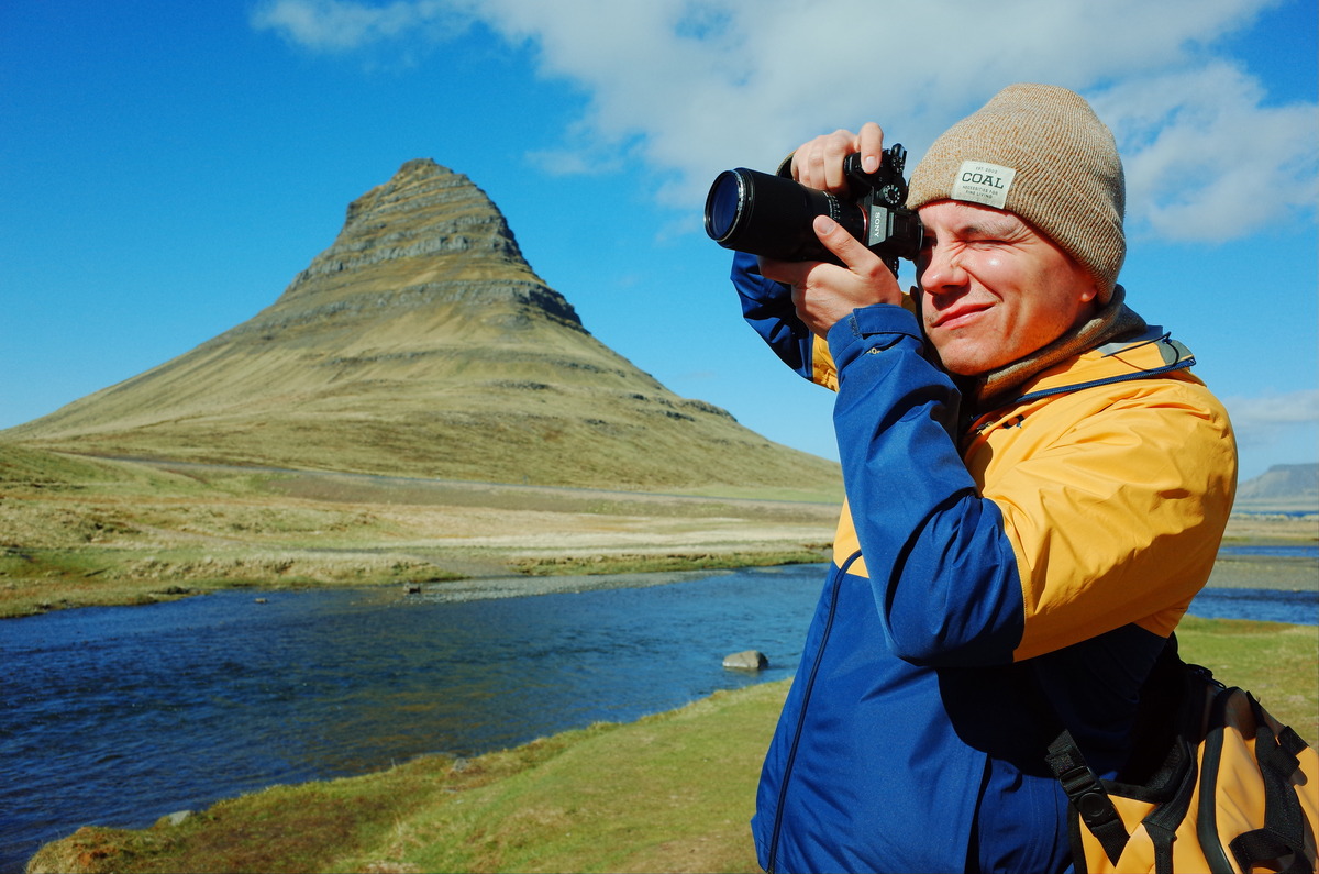
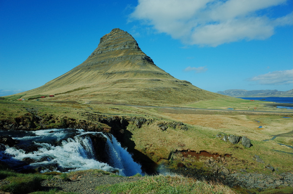
After we left Saxhóll Crater, Myles and I continued along Route 54 towards Kirkjufell, which is referred to as the wizards hat. The mountain is one of Iceland’s iconic landmarks. From the crater, it took us a half hour to reach Kirkjufell. It was a gorgeous drive, with consistent coastal views. Along a bend in the road, the distinct conical shape of Kirkjufell came into view, with the slopes framed by the sea and sky. Despite its unique shape and beauty, the area was crowded with tourists. The parking lot was overflowed with cars, adventure vans, and large groups of tourists. A payment system was present in the parking lot but didn’t accept payments.
Myles and I explored the area in front of Kirkjufell after we parked. A trail led from the parking lot towards Kirkjufellfoss, a nearby waterfall. As the base of the waterfall provides a perfect vantage point for photographs of Kirkjufell, the path was well-worn from years of tourism. The viewpoint was stunning, with the mountain rising sharply against the sky. The mountain is next to Route 54, however, which made it difficult to photograph without vehicles being in the frame. Tourists were constantly leaving and arriving. After we finished with photographs, Myles and I returned to the vehicle and continued on the road to Grundarfjörður.
Grundarfjörður was a small coastal town, sat in the shadow of Kirkjufell. The town was quiet and remote, with colorful houses set against the backdrop of steep mountains and the sea. After a long day, Myles and I went to a restaurant called Kaffi 59 for dinner. The restaurant had a welcome atmosphere, with wooden tables and large counter near the entrance. We sat near the windows, where Kirkjufell was visible in the distance off to our left. Myles and I ordered a pizza called Eyrarfjall, which came topped with Pitsusósa, ostur, nautahakk, skinka, and pepperoni. Though I burnt the roof of my mouth, it was a delicious pizza.
After we paid the bill, Myles and I left Grundarfjörður and returned to Reykjavik. We stayed on Route 54, and passed familiar scenery of lava fields and mountains. We turned off on Route 56 for a shortcut, which was a rolling road with views of wide valleys and hills. Eventually, Route 56 reconnected with Route 54, which we stayed on until we reconnected with Route 1. It was a long drive, with two stops. Myles and I stopped for coffee at the Hotel Snaefellsnes and a bathroom break at an N1 station in the town of Borgarnes. By the time we arrived at our hotel, the sky was a deep blue, and the streets were near empty.